
The Ministry of Interior and National Administration has identified at least 37 neighborhood in Nairobi, which are at risk of facing prolonged flooding during the heavy rains that continues to pound the country.
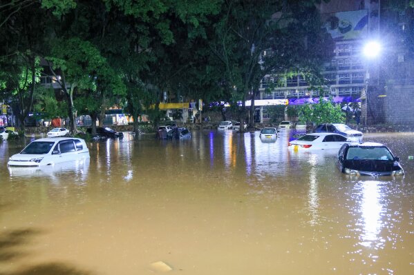
In a statement issued on Sunday March 15, the Ministry announced that the 37 areas have been marked as flood-prone due to their close proximity to the City’s major river corridors and locations.
“Heavy rains that continues to be experienced in different parts of the country, is increasing the risk of flooding in both rural and urban areas, with Nairobi among the most affected,” said Ministry of interior in a press statement.
“A mapping exercise conducted under the Nairobi Rivers Regeneration Programme has identified 37 neighbourhoods located along major river corridors and locations vulnerable to flooding,” added the statement.
The Nairobi Rivers Regeneration Programme’s mapping exercise reveals that areas like Kiambiu, Dandora, and Kariobangi in Nairobi East, and Madaraka, Lang’ata, and Kawangware in Nairobi West are at high risk of flooding.
Within Nairobi Central, key locations along the river corridor include the Central Business District (CBD), Globe, Gikomba, Eastleigh, and the Industrial Area, where sections of Nairobi River pass through.
Additionally, other vulnerable neighborhoods include Mathare, Korogocho, and Lucky Summer in Nairobi North, and Kilimani, Kibera, and Mukuru Kwa Reuben in Nairobi South.
Residents in these areas are being urged to remain cautious, especially those living near riparian zones and low-lying areas, as disaster response teams work to coordinate relief efforts.
